Geostationary satellites
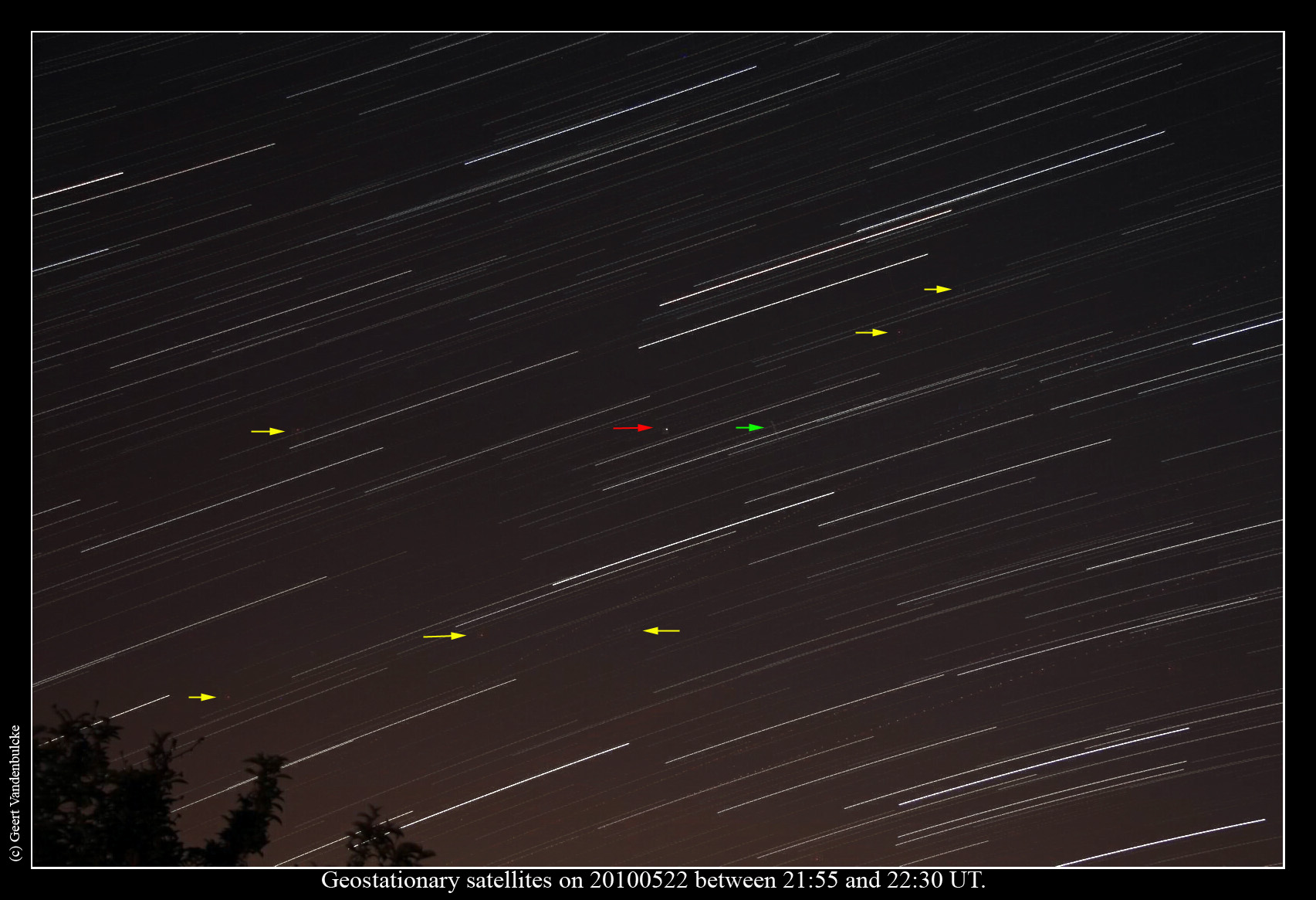
Following a message on the VVS mailing list about a geostationary satellite that brightened to naked eye visibility on the nights arround 23 May 2010 between midnight and 00:30 local time, I made the image below showing the bright satellite but also some less bright ones in the neighbourhood. The image was made with my Canon EOS 40D with 17-85mm lens (at 35 mm), mounted on a tripod. A sequence of 69 images of 30s each were made, then combined with Startrails software.
The red arrow points to the satellite that reached a magnitude of about 2.5, the yellow arrows show some other satellites I think. The short trail shown at the green arrow was identified as being a military slow moving satellite. The faint dotted lines are produced by aircraft that crossed the image field.